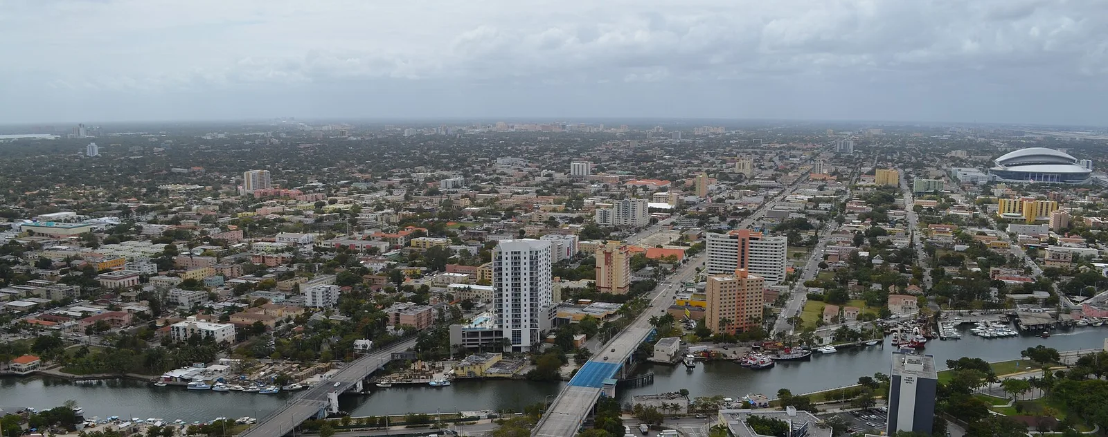
The City of Miami's 11 NET areas, from Flagami to the Upper Eastside, with each one's ZIP codes, zoned high school and typical home value.
Last checked Oct. 10, 2026. Sources: the City of Miami’s NET areas layer and neighborhoods layer, Miami-Dade County’s open data (address points and school attendance boundaries), the Florida Department of Education’s 2026 school grades, Zillow Research, the Census Bureau’s QuickFacts, Miami-Dade Transit’s published schedule data and OpenStreetMap.
The City of Miami is home to 459,745 people, according to the Census Bureau’s 2020-2024 American Community Survey. It is one of many cities in Miami-Dade County, and much of what people call “Miami” is outside it: Miami Beach, Coral Gables, Hialeah and the unincorporated communities to the south and west are separate places with their own governments.
Inside the city, Interstate 95 runs north to south just west of downtown, the Dolphin Expressway (State Road 836) runs west to the airport and Metrorail follows U.S. 1 south from downtown through Coral Way and north through Overtown and Allapattah. The city uses 11 Neighborhood Enhancement Team (NET) areas to organize neighborhood services, and this guide uses the same 11, with a page for each.
What this means for you
- The address decides the city. A Miami mailing address can be in another city or in unincorporated Miami-Dade. Check the municipality on the property appraiser’s search.
- School zones do not follow neighborhood lines. City addresses are split among seven main high school zones, and the most common, Coral Gables Senior High, is in Coral Gables. Use the School Locator.
- ZIP codes cross the city line too. Zillow files some city ZIP codes, such as 33142 and 33150, under neighboring communities.
The areas at a glance
Each area’s main ZIP code is the one with the most county address points inside it; the zoned high school is the one covering the most addresses, from Miami-Dade County’s attendance boundary layer. Home values are the Zillow Home Value Index for August 2026, a modeled typical value for the middle third of homes, not a sale price.
| Area | Main ZIP | Main zoned high school (share) | Typical value in main ZIP | Guide |
|---|---|---|---|---|
| Allapattah | 33142 | Miami Jackson Senior High (78%) | $426,496 | Allapattah |
| Coconut Grove | 33133 | Coral Gables Senior High (100%) | $1,365,684 | Coconut Grove |
| Coral Way | 33145 | Coral Gables Senior High (51%) | $735,449 | Coral Way |
| Downtown/Brickell | 33132 | Booker T. Washington Senior High (74%) | $513,694 | Downtown and Brickell |
| Flagami | 33126 | South Miami Senior High (49%) | $298,325 | Flagami |
| Little Haiti | 33127 | Miami Edison Senior High (85%) | $529,035 | Little Haiti |
| Little Havana | 33125 | Miami Senior High (61%) | $462,144 | Little Havana |
| Model City | 33142 | Miami Northwestern Senior High (80%) | $426,496 | Model City |
| Overtown | 33136 | Booker T. Washington Senior High (100%) | $318,604 | Overtown |
| Upper Eastside | 33138 | Miami Edison Senior High (85%) | $807,740 | Upper Eastside |
| Wynwood/Edgewater | 33127 | Booker T. Washington Senior High (100%) | $529,035 | Wynwood and Edgewater |
The citywide Zillow figure was $580,866 in August 2026, up 0.8% on the year. More in our home prices guide and schools guide.
Map
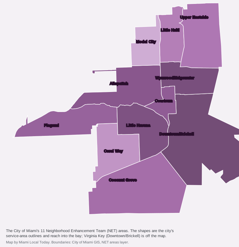
Map by Miami Local Today from the City of Miami’s NET areas layer. The city’s outlines are drawn for service districts and reach into Biscayne Bay.
The areas
Allapattah runs from I-95 west toward the airport between the Airport Expressway and the Dolphin Expressway. It has three Metrorail stations (Allapattah, Santa Clara and UHealth Jackson), the Civic Center medical district on its southern edge and Melreese Golf Course at its western end. Most addresses are in ZIP 33142.
Coconut Grove is the bayfront area between U.S. 1 and Biscayne Bay south of downtown, including Dinner Key, where Miami City Hall stands, and the Vizcaya and Bay Heights neighborhoods. Every address is zoned for Coral Gables Senior High, and ZIP 33133’s typical value, $1,365,684, was up 10.1% on the year.
Coral Way is the residential stretch from West Flagler Street to U.S. 1 between Little Havana and the Coral Gables line, with the Coconut Grove and Douglas Road Metrorail stations and The Underline park along its southern edge. Its high school zone is split almost evenly between Coral Gables Senior High and Miami Senior High.
Downtown/Brickell covers the central business district, Brickell and the city’s islands, from Brickell Key and Watson Island to Virginia Key. Most homes are in towers. It has two Metrorail stations and the free Metromover.
Flagami is the long western strip between Tamiami Trail and the Dolphin Expressway, out to the city line near 72nd Avenue. It is split among four high school zones and is about 3.6 miles by road from Miami International Airport.
Little Haiti runs north from about 36th Street to the city line, mostly between I-95 and Northeast Fourth Avenue, and includes Lemon City, Little River, Edison and Buena Vista. Most addresses are zoned for Miami Edison Senior High.
Little Havana is just west of downtown with Calle Ocho through its middle, from the Miami River south to Southwest Ninth Street and, east of 17th Avenue, through The Roads. Most addresses are zoned for Miami Senior High, an A school in 2026. For things to do there, see our Little Havana guide.
Model City is west of I-95 and north of the Airport Expressway, and includes Liberty City and Liberty Square. About 80% of addresses are zoned for Miami Northwestern Senior High, an A school in 2026.
Overtown is just northwest of downtown, with the Historic Overtown/Lyric Theatre and Culmer Metrorail stations and Booker T. Washington Senior High. ZIP 33136’s typical value fell 6.1% on the year.
Upper Eastside runs along Biscayne Bay north of the Julia Tuttle Causeway, with Biscayne Boulevard up its middle and 13 named neighborhoods, including Morningside and Shorecrest. All three of its elementary zones earned an A in 2026.
Wynwood/Edgewater sits between I-95 and the bay just north of downtown: Wynwood, Midtown, the Design District and Edgewater. It is about 2.4 miles by road from Government Center.
How school zones cut across the city
On Miami-Dade County’s high school attendance layer, the city’s county address points fall into these zones:
| High school | Share of city addresses | 2026 grade |
|---|---|---|
| Coral Gables Senior High | 22% | B |
| Miami Senior High | 19% | A |
| Booker T. Washington Senior High | 18% | I (incomplete) |
| Miami Jackson Senior High | 14% | B |
| Miami Edison Senior High | 12% | C |
| Miami Northwestern Senior High | 8% | A |
| South Miami Senior High | 8% | B |
The two Venetian Causeway islands in the city, San Marco and Biscayne, are zoned for Miami Beach Senior High. Grades are from the state’s 2026 school grades.
How we built this
The 11 areas are the City of Miami’s own Neighborhood Enhancement Team areas, from the city’s NET areas layer. The smaller neighborhoods named on each page come from the city’s neighborhoods layer, which lists about 100, with a few place names checked against OpenStreetMap (© OpenStreetMap contributors). We did not draw any boundaries of our own.
For each area we took every Miami-Dade County address point inside the city’s outline (77,313 in the city) and matched them to the county’s elementary, middle and high school attendance boundary layers and to ZIP codes on Oct. 10, 2026. The county’s address layer has one point per building, so a condo tower counts once. Distances come from the OpenStreetMap road network using the OSRM routing engine, and bus and rail routes from Miami-Dade Transit’s published schedule data. More: moving to Miami, getting around and your town, county and neighbors.
Frequently asked questions
What are the main neighborhoods in Miami?
The City of Miami organizes its neighborhood services into 11 NET areas: Allapattah, Coconut Grove, Coral Way, Downtown/Brickell, Flagami, Little Haiti, Little Havana, Model City, Overtown, Upper Eastside and Wynwood/Edgewater. Its neighborhoods layer names about 100 smaller neighborhoods inside them.
Do Miami school zones follow neighborhood lines?
No. Miami-Dade County Public Schools draws its own attendance zones. Coral Way is split almost evenly between Coral Gables Senior High and Miami Senior High, and Flagami is split among four high school zones. Check an address with the district’s School Locator.
Which Miami neighborhoods have Metrorail stations?
Allapattah, Coral Way, Downtown/Brickell, Overtown and Little Havana have Metrorail stations inside their NET areas. Coconut Grove, Flagami, Little Haiti, Model City, the Upper Eastside and Wynwood/Edgewater have none.
Where are home values highest in Miami?
Among the main ZIP codes of the city’s NET areas, Zillow’s typical home value in August 2026 was highest in 33133 (Coconut Grove), at $1,365,684, and lowest in 33126 (part of Flagami), at $298,325. The citywide figure was $580,866.
How many people live in Miami?
459,745, according to the Census Bureau’s American Community Survey 2020-2024 five-year estimates.
Have your say