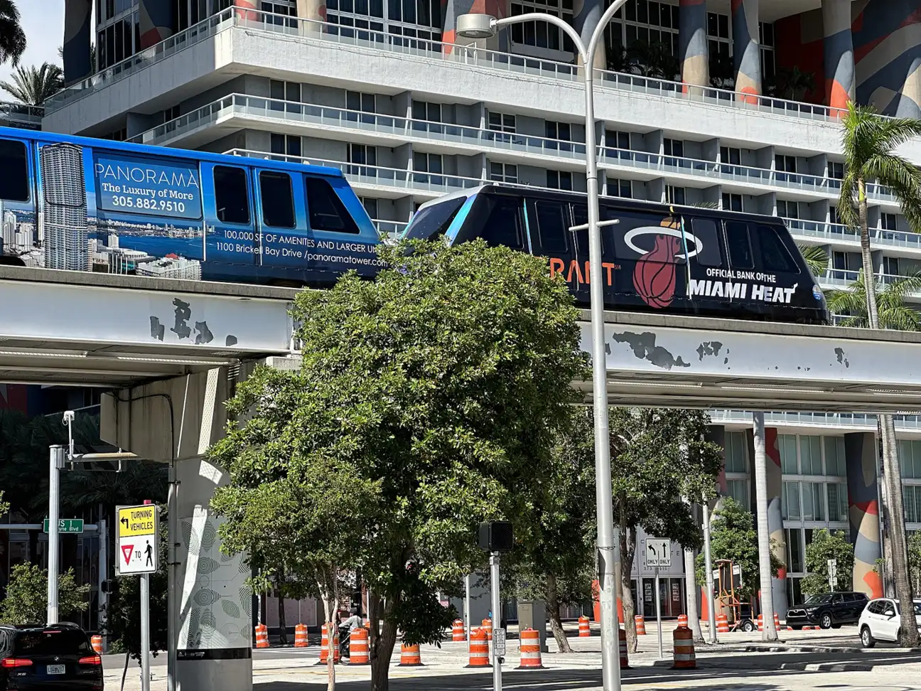
Getting around Miami: free Metromover and city trolleys, Metrorail's Orange Line to MIA, Metrobus, the main state roads and where to check closures.
Last checked Oct. 9, 2026. Sources: Miami-Dade County’s Metrorail, Metromover and Metrobus pages, the City of Miami’s trolley page, Miami International Airport’s public transportation page and FDOT District Six’s project site.
Miami has four ways to get around without a car: county Metrorail, a free Metromover downtown, Metrobus, and the city’s free trolleys. Drivers this month also face overnight closures for the I-395 rebuild.
Who to call
- Miami-Dade transit information: 311
- City of Miami Trolley: 305-416-1132; live tracker
- Traffic and closures: FL511, or dial 511
- Plan a trip: the county’s GO Miami-Dade Transit app (see the county’s mobile apps page)
The main roads
These state roads run through the city, by their FDOT names:
- I-95.
- I-395, from I-95 to Biscayne Boulevard; it is being rebuilt with a new signature bridge, finish expected December 2029.
- SR 836 (Dolphin Expressway), being double-decked to link directly with the MacArthur Causeway.
- I-195 / SR 112 (Julia Tuttle Causeway and Airport Expressway).
- U.S. 1, which is Biscayne Boulevard north of downtown, Brickell Avenue and South Dixie Highway to the south.
- U.S. 41 (SW Eighth Street and SW Seventh Street) through Little Havana.
- SR 9 (NW 27th Avenue), SR 953 (Le Jeune Road), SR 972 (Coral Way) and SR 976 (Bird Road).
Current closures on all of them are on our road construction and closures page, refreshed weekly.
Metrorail
Miami-Dade’s Metrorail is a 25-mile elevated line from Kendall through South Miami, Coral Gables and downtown, to the Civic Center and Jackson Memorial Hospital area, and on to Brownsville, Liberty City, Hialeah and Medley. It connects to:
- Miami International Airport (Orange Line) and Tri-Rail (Green Line).
- Brightline, at the Historic Overtown/Lyric Theatre station.
Pay with contactless cards, an EASY Card or Ticket, or the GO Miami-Dade Transit app. Each car has bicycle racks, and stations have bike racks.
Metromover: free downtown
The Metromover is a free elevated people mover with 21 stations on three loops, Omni, Inner and Brickell, from the Financial District station in Brickell to the School Board station in Omni. It runs 5:30 a.m. to 10 p.m. daily and stops near the Kaseya Center, Bayside Marketplace and Miami Dade College. The county is upgrading it, and some weekends bring loop closures with free shuttle buses; check the Metromover page.
Metrobus
Metrobus covers the county, out to Miami Beach, Key Biscayne, Broward County and the Keys. The fare is $2.25 ($1.10 discount); inter-county express routes cost more. Pay with an EASY Card or Ticket, the app, a contactless card or cash. Buses carry bikes on front racks. Routes and schedules.
The free city trolley
The City of Miami runs 13 free trolley routes. From the city’s schedule:
| Route | Weekdays | Saturday | Sunday |
|---|---|---|---|
| Allapattah, Brickell, Coral Way, Little Havana | 6:30 a.m. to 11 p.m. | 6:30 a.m. to 11 p.m. | 8 a.m. to 8 p.m. |
| Biscayne | 6:30 a.m. to midnight | 6:30 a.m. to midnight | 8 a.m. to 8 p.m. |
| Little Haiti | 6:30 a.m. to 8 p.m. | 6:30 a.m. to 8 p.m. | 8 a.m. to 8 p.m. |
| Coconut Grove, Flagami, Health District, Stadium, Wynwood | 6:30 a.m. to 11 p.m. | 6:30 a.m. to 11 p.m. | No service |
| Liberty City | 6:30 a.m. to 10 p.m. | 8 a.m. to 5 p.m. | No service |
| Overtown | 6:30 a.m. to 7 p.m. | No service | No service |
The trolley does not go to Miami Beach. The Biscayne route is on a detour from Sept. 23 until further notice, the city says.
Miami International Airport
At MIA, Metrobus, Metrorail and Tri-Rail all stop at the Miami Intermodal Center / MIA station, where EASY Card machines sell fares. The airport’s free MIA Mover, on the third level between the Dolphin and Flamingo garages, links the terminals to the Rental Car Center. Metrorail’s Orange Line runs from MIA through Earlington Heights, Allapattah, Santa Clara, Civic Center, Culmer, Historic Overtown/Lyric Theatre, Government Center, Brickell, Vizcaya, Coconut Grove and on to Dadeland North.
Parking
On-street parking and many public garages in the city are managed by the Miami Parking Authority (miamiparking.com), which shares parking enforcement with the City of Miami Police and Miami-Dade County, according to the Miami-Dade Beacon Council. Rates and hours differ by block, so read the posted sign at the space. Several Metrorail stations have parking for riders.
What this means for you
- Downtown, Brickell and Omni: use the free Metromover before you pay to park.
- To MIA: the Orange Line from Brickell or Government Center avoids airport parking.
- Driving late on SR 836 or I-395 this month? Check our closures page first.
Related: parks and trails, moving to Miami and things to do this month.
Frequently asked questions
Is the Metromover free in Miami?
Yes. Miami-Dade County’s Metromover is a free elevated people mover serving 21 stations in downtown, Omni and Brickell, from 5:30 a.m. to 10 p.m. seven days a week.
How do I get from Miami International Airport to downtown Miami by train?
Take Metrorail’s Orange Line from the Miami Intermodal Center/MIA station. It stops at Earlington Heights, Allapattah, Santa Clara, Civic Center, Culmer, Historic Overtown/Lyric Theatre, Government Center and Brickell, among others.
Is the Miami Trolley free?
Yes. The City of Miami’s trolley is free and runs 13 routes, most from 6:30 a.m. to 11 p.m. on weekdays. Call 305-416-1132 for schedules.
How much is a bus fare in Miami?
Metrobus fare is $2.25, with a $1.10 discount fare, according to Miami-Dade County. Pay with an EASY Card, EASY Ticket, the GO Miami-Dade Transit app, contactless payment or cash.
Where can I check traffic and road closures in Miami?
Use FL511 (fl511.com, or dial 511) and FDOT District Six’s fdotmiamidade.com. Our road construction page lists this week’s closures.
Have your say