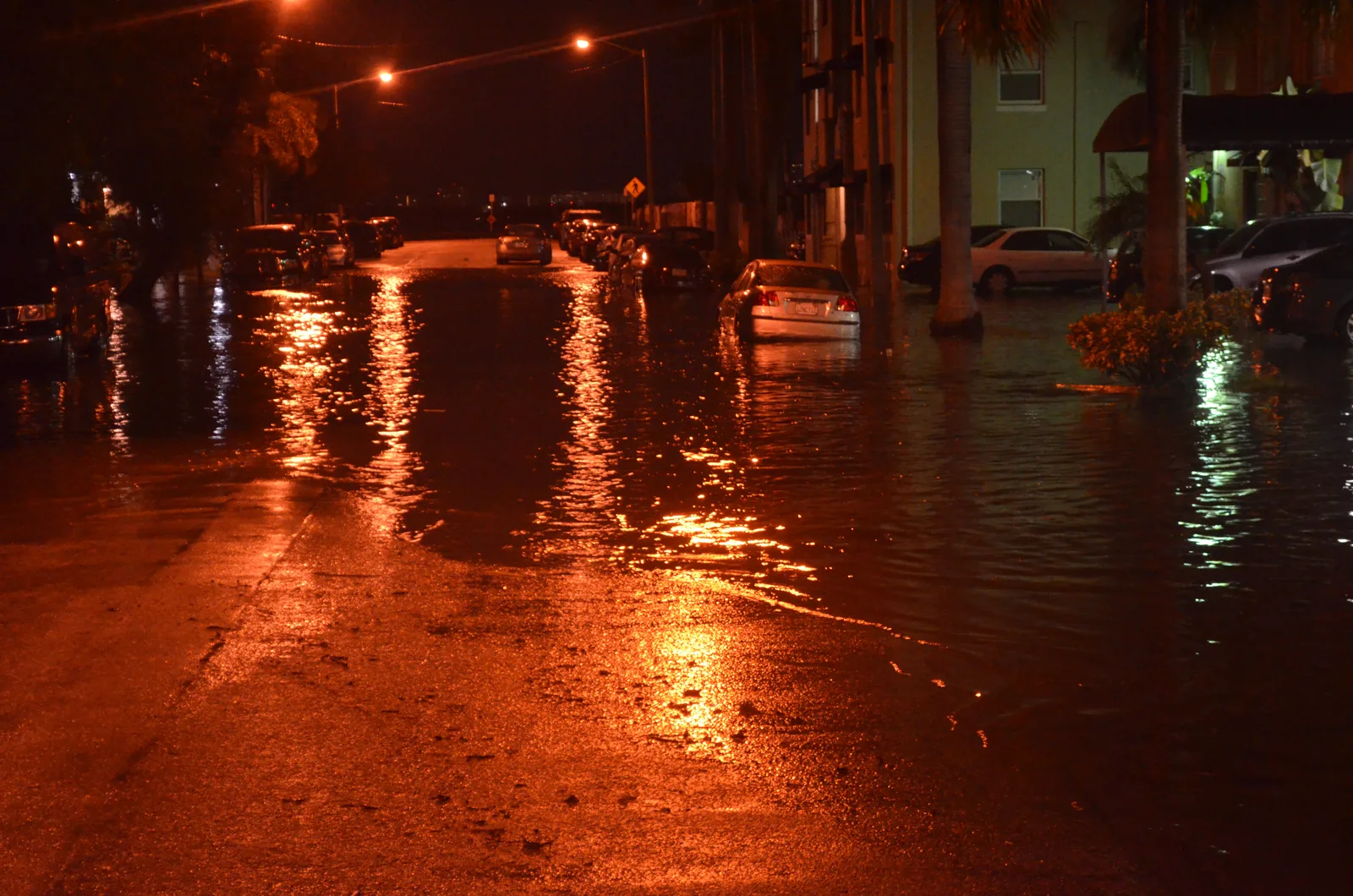
NWS Miami warns of significant coastal flooding late Sunday through Tuesday morning. Virginia Key has hit moderate flood stage four days running. Peak tide times inside.
Significant coastal flooding is possible in Miami from late Sunday night through Tuesday morning, the National Weather Service in Miami said. It issued a coastal flood watch for coastal Miami-Dade County from 2 a.m. Monday to 11 a.m. Tuesday.
A coastal flood advisory for moderate flooding stays in effect until 2 a.m. Monday. The weather service also warned of a high risk of dangerous rip currents through Monday evening. The alerts are in the office’s coastal hazard message issued at 3:21 p.m. Saturday.
The water is already higher than the king tide predictions. The tide gauge at Virginia Key has reached moderate flood stage every day since Wednesday.
What the weather service expects
The weather service listed these possible impacts for coastal Miami-Dade:
- numerous roads may be closed
- low-lying homes, businesses and some critical infrastructure may be flooded
- some shoreline erosion
- rip currents strong enough to sweep even strong swimmers away from shore
A watch means significant flooding could happen. An advisory means flooding is happening or expected, at a lesser level than a warning.
How high the water has been
The weather service sets flood stages for the Virginia Key tide gauge in feet above mean higher high water, the average height of the day’s higher high tide. Minor flooding starts at 1.3 feet, moderate at 1.7 feet and major at 2.5 feet.
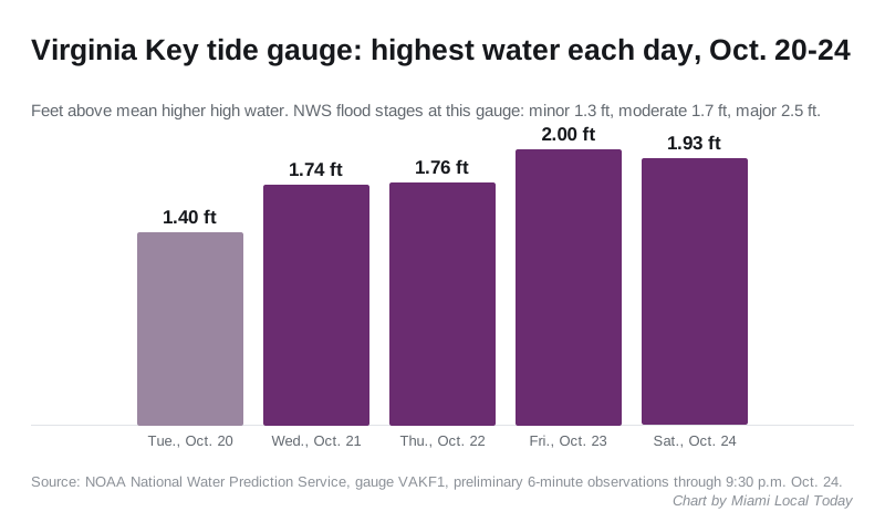
The gauge’s preliminary readings show the highest water each day was:
- Tuesday, Oct. 20: 1.40 feet (minor)
- Wednesday, Oct. 21: 1.74 feet (moderate)
- Thursday, Oct. 22: 1.76 feet (moderate)
- Friday, Oct. 23: 2.00 feet, at about 7:10 a.m. (moderate)
- Saturday, Oct. 24: 1.93 feet, at about 8:20 a.m. (moderate)
The Haulover gauge on the Intracoastal Waterway, about 10 miles north, read 1.92 feet Friday morning and 1.84 feet Saturday morning.
That is well above what the tide alone would bring. NOAA’s tide predictions for Virginia Key put Friday morning’s high tide at 0.41 feet and Saturday morning’s at 0.54 feet on the same scale. So the water ran about 1.4 to 1.6 feet higher than predicted.
The predicted tide keeps rising until Tuesday. NOAA puts the morning high tides at:
| Day | Morning high tide | Evening high tide |
|---|---|---|
| Sunday, Oct. 25 | 8:58 a.m. | 9:04 p.m. |
| Monday, Oct. 26 | 9:44 a.m. | 9:48 p.m. |
| Tuesday, Oct. 27 | 10:31 a.m. | 10:34 p.m. |
Those predictions cover the moon and sun only, not wind or rain. The weather service forecast for Miami calls for northeast wind gusting to 35 mph on Monday, with showers and thunderstorms likely Sunday through Monday night. Up to three-quarters of an inch of rain is possible Sunday night alone.
What it means for you
The flooding is worst for about 90 minutes either side of each high tide, the city’s king tides page says. For Monday and Tuesday mornings, that means roughly 8:15 a.m. to 11:15 a.m. Monday and 9 a.m. to noon Tuesday.
- Move cars out of low-lying streets and parking lots before the morning high tides.
- Do not drive around barricades or through water of unknown depth, the weather service said.
- Allow extra time if you have to travel, because some roads may be closed.
- Rinse your car with fresh water if it goes through salt water.
- Stay out of the ocean unless a lifeguard is on duty. If a rip current catches you, float and swim parallel to the shore, the weather service said.
Report street flooding to the city through 311 or 305-468-5900. Our king tides guide has the rest of this week’s peak times and the November dates. Lane closures on the highways are on our road construction and closures page. For storm supplies and evacuation zones, see our hurricane prep guide.
Have your say