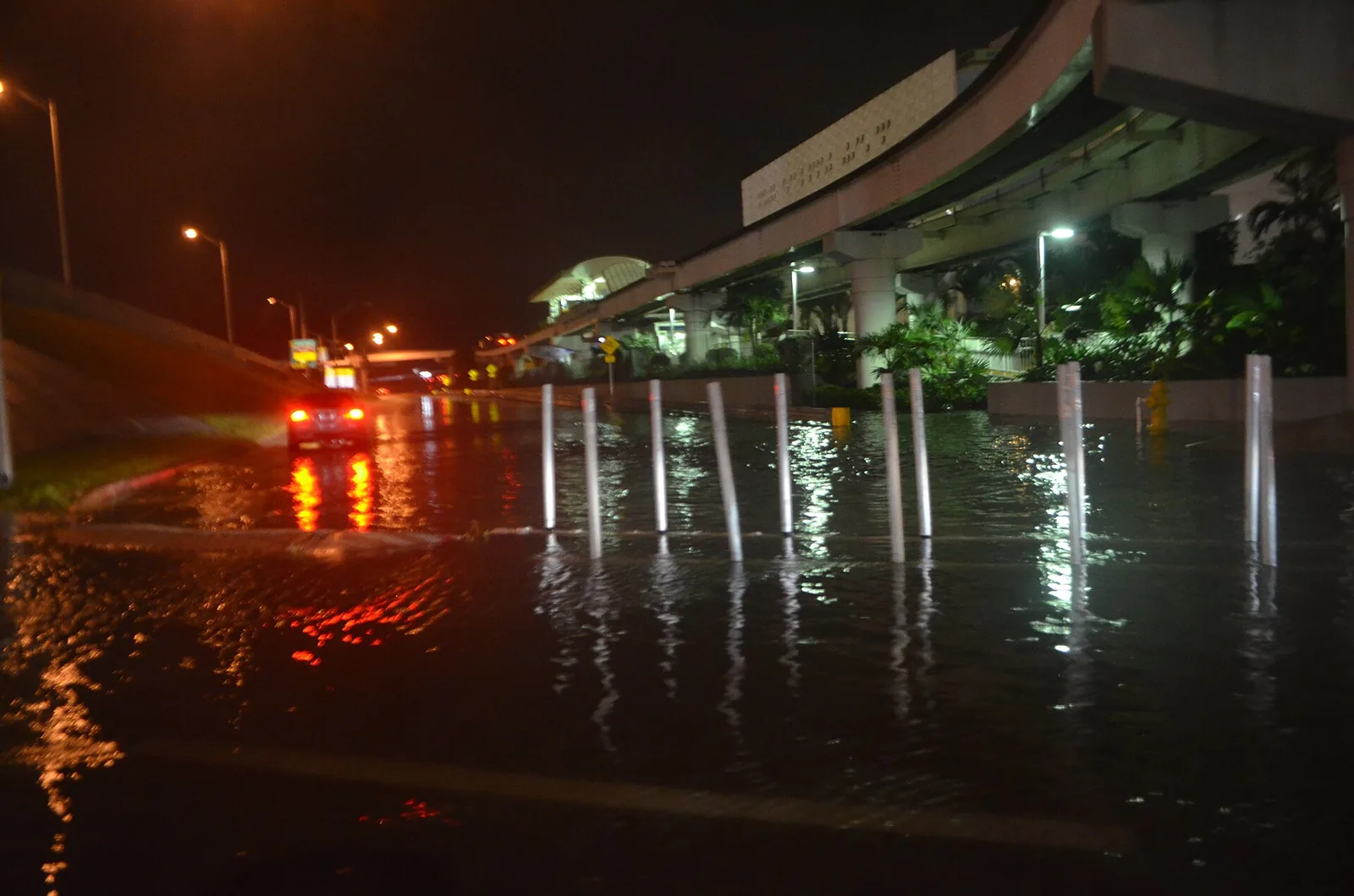
The year's highest tides hit Miami Oct. 24-30, topping out near 10:30 a.m. Oct. 27. Peak times for each day, how long streets flood and how to report it.
Updated Oct. 25: The water has run well above these predictions. The Virginia Key gauge reached moderate flood stage every day from Oct. 21 to Oct. 24, and the National Weather Service has issued a coastal flood watch for late Sunday through Tuesday morning. See our coastal flood watch story for the latest.
The highest tides of the year return to Miami next week. Low-lying streets near the coast and the city’s waterways can flood for a few hours around each high tide from Saturday, Oct. 24, to Friday, Oct. 30.
Miami-Dade County’s Environmental Resources Management office issued a king tide notice on Tuesday. It says the Oct. 24-30 window brings the highest predicted tide of the fall. Two more windows follow in November.
When the water peaks
The City of Miami’s king tides page lists the peak time for each day. Flooding, where it happens, typically lasts about three hours, the city said: roughly 90 minutes before the peak and 90 minutes after.
| Day | Morning peak | Evening peak |
|---|---|---|
| Saturday, Oct. 24 | 8:11 a.m. | 8:20 p.m. |
| Sunday, Oct. 25 | 8:58 a.m. | 9:04 p.m. |
| Monday, Oct. 26 | 9:44 a.m. | 9:48 p.m. |
| Tuesday, Oct. 27 | 10:31 a.m. | 10:34 p.m. |
| Wednesday, Oct. 28 | 11:20 a.m. | 11:23 p.m. |
| Thursday, Oct. 29 | 12:11 p.m. | none listed |
| Friday, Oct. 30 | 1:07 p.m. | none listed |
So on Tuesday, Oct. 27, the worst of any flooding would run from about 9 a.m. to noon.
How high the tide is predicted to go
The highest tide of the week is Tuesday morning. NOAA’s tide predictions for its Virginia Key station put the 10:31 a.m. high tide that day at 2.98 feet above mean lower low water, the benchmark used on nautical charts.
That is about 9 inches above the station’s average daily high tide, which NOAA’s station datums put at 2.25 feet above the same benchmark.
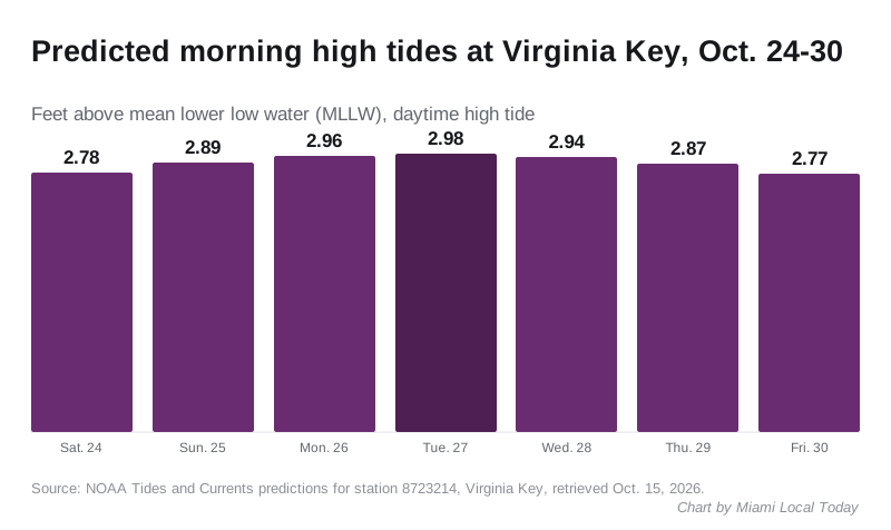
The daytime predictions at Virginia Key are:
- Saturday, Oct. 24: 2.78 feet
- Sunday, Oct. 25: 2.89 feet
- Monday, Oct. 26: 2.96 feet
- Tuesday, Oct. 27: 2.98 feet
- Wednesday, Oct. 28: 2.94 feet
- Thursday, Oct. 29: 2.87 feet
- Friday, Oct. 30: 2.77 feet
NOAA’s flood levels for the station set the National Weather Service’s minor flooding threshold at about 3.5 feet above mean lower low water. The predicted tides stay below that. Tide predictions cover the moon and sun only, not wind or rain, so a wet or windy morning can push the water higher than the table.
What it means for you
The county and the city both gave the same basic advice:
- Do not park in low-lying areas, the city said. The county said to move cars to higher ground before the tides begin.
- Do not drive through floodwater. The city said it may be deeper than it looks and can hide debris that causes flat tires.
- If your car does go through salt water, rinse it with fresh water and have it checked.
- Keep children out of floodwater. If you touch it, wash with soap and hot water.
- Boaters should check the tide before leaving the dock. High tides cut the clearance under fixed bridges.
- Homes and businesses in low-lying areas can use sandbags, the city said.
To see whether your block is prone to tidal flooding, the county pointed residents to the “flood frequency” tab of NOAA’s Sea Level Rise Viewer.
How to report flooding
The city takes flooding reports through 311 or 305-468-5900, and by email to internetpublicworks@miamigov.com. The city’s page also asks residents to log king tide photos with the citizen science project ISeeChange.
The rest of the season
The county’s notice lists two more king tide windows this fall:
- Friday, Nov. 6, to Monday, Nov. 9
- Monday, Nov. 23, to Thursday, Nov. 26 (Thanksgiving Day)
For storm season planning, see our Miami hurricane prep guide. Planned lane closures on the highways are on our road construction and closures page.
Have your say