Little Havana, between the Miami River and Coral Way, is mostly zoned for Miami Senior High, an A school in Florida's 2026 grades.
Last checked Oct. 10, 2026. Sources: the City of Miami’s NET areas layer, neighborhoods layer and parks layer, Miami-Dade County’s open data (address points and school attendance boundaries), the Florida Department of Education’s 2026 school grades, Zillow Research, Miami-Dade Transit’s published schedule data and OpenStreetMap.
Little Havana is the City of Miami NET area just west of downtown, with Calle Ocho (Southwest Eighth Street) running through its middle. This page covers where to live there: schools, home values, parks and transit. For Domino Park, Ball & Chain, Viernes Culturales and the rest of what to do, see our Little Havana and Calle Ocho guide.
What this means for you
- Zoned high school: Miami Senior High for about 61% of addresses, an A school in Florida’s 2026 grades. Check yours with the district’s School Locator.
- Home value: between $462,144 (ZIP 33125) and $735,449 (33145) in August 2026, according to the Zillow Home Value Index.
- Nearest Metrorail: UHealth Jackson station, about 1.9 miles by road from the middle of the area; Vizcaya station is at its southern tip.
Part of our Miami neighborhoods guide.
Where it is
On the city’s NET map, Little Havana runs roughly from the Miami River south to Southwest Ninth Street, between Interstate 95 on the east and 27th Avenue on the west. East of 17th Avenue it reaches farther south, through The Roads, to South Dixie Highway near Vizcaya. Downtown/Brickell and Overtown are to the east, Coral Way to the south and Flagami and Allapattah to the west and north.
The city’s neighborhoods layer names seven places inside it: East Little Havana, the Latin Quarter, Little Managua, Citrus Grove, the Orange Bowl, South Sewell Park and Roads.
Miami-Dade County’s address data spreads the area’s address points over six ZIP codes: a quarter each in 33125 and 33135, and the rest in 33130, 33129, 33145 and 33128.
Schools
How the area’s county address points fall in Miami-Dade County Public Schools’ attendance boundary maps, with each school’s 2026 grade from the Florida Department of Education. The percentage in parentheses is the share of possible points the school earned.
| Level | School | Share of addresses | 2026 grade |
|---|---|---|---|
| Elementary | Coral Way K-8 Center, 1950 SW 13th Ave. (report card) | 31% | A (69%) |
| Elementary | Riverside Elementary, 1190 SW Second St. (report card) | 27% | C (51%) |
| Elementary | Citrus Grove K-8 Center, 2121 NW Fifth St. (report card) | 27% | C (53%) |
| Elementary | Shenandoah Elementary, 1023 SW 21st Ave. (report card) | 12% | A (63%) |
| Middle | Shenandoah Middle, 1950 SW 19th St. (report card) | 44% | B (58%) |
| Middle | Jose de Diego Middle, 3100 NW Fifth Ave. (report card) | 30% | B (60%) |
| Middle | Citrus Grove Middle, 2153 NW Third St. (report card) | 25% | Not in the 2026 file |
| High | Miami Senior High, 2450 SW First St. (report card) | 61% | A (68%) |
| High | Booker T. Washington Senior High, 1200 NW Sixth Ave. (report card) | 31% | I (incomplete) |
| High | Miami Jackson Senior High, 1751 NW 36th St. (report card) | 8% | B (61%) |
Miami Senior High is at 2450 SW First St. “I” means the state listed Booker T. Washington’s 2026 grade as incomplete, and Citrus Grove Middle has no row in the state’s 2026 grades file. Check the exact address with the School Locator. More in our schools guide.
Home values
From the Zillow Home Value Index for the ZIP codes that cover the area. The index is a modeled typical value for the middle third of homes, single-family homes and condos together, not a sale price, and each figure covers the whole ZIP code, not just this area.
| ZIP code | Share of area addresses | Typical value, Aug. 2026 | Change on the year |
|---|---|---|---|
| 33125 | 25% | $462,144 | up 0.2% |
| 33135 | 25% | $526,602 | up 2.0% |
| 33130 | 18% | $511,238 | down 1.2% |
| 33129 | 14% | $693,666 | down 0.5% |
| 33145 | 12% | $735,449 | up 5.8% |
| 33128 | 5% | $433,368 | down 2.1% |
The citywide Miami figure was $580,866 in August 2026, up 0.8% on the year. More in our home prices guide.
Parks
From the city’s parks layer, inside the area:
- E.G. Sewell Park, 1815 NW South River Drive, about 11 acres on the Miami River.
- Jose Marti Park, 362 SW Fourth St., about 9 acres on the river.
- Fern Isle Park, 2201 NW 11th St., about 9 acres.
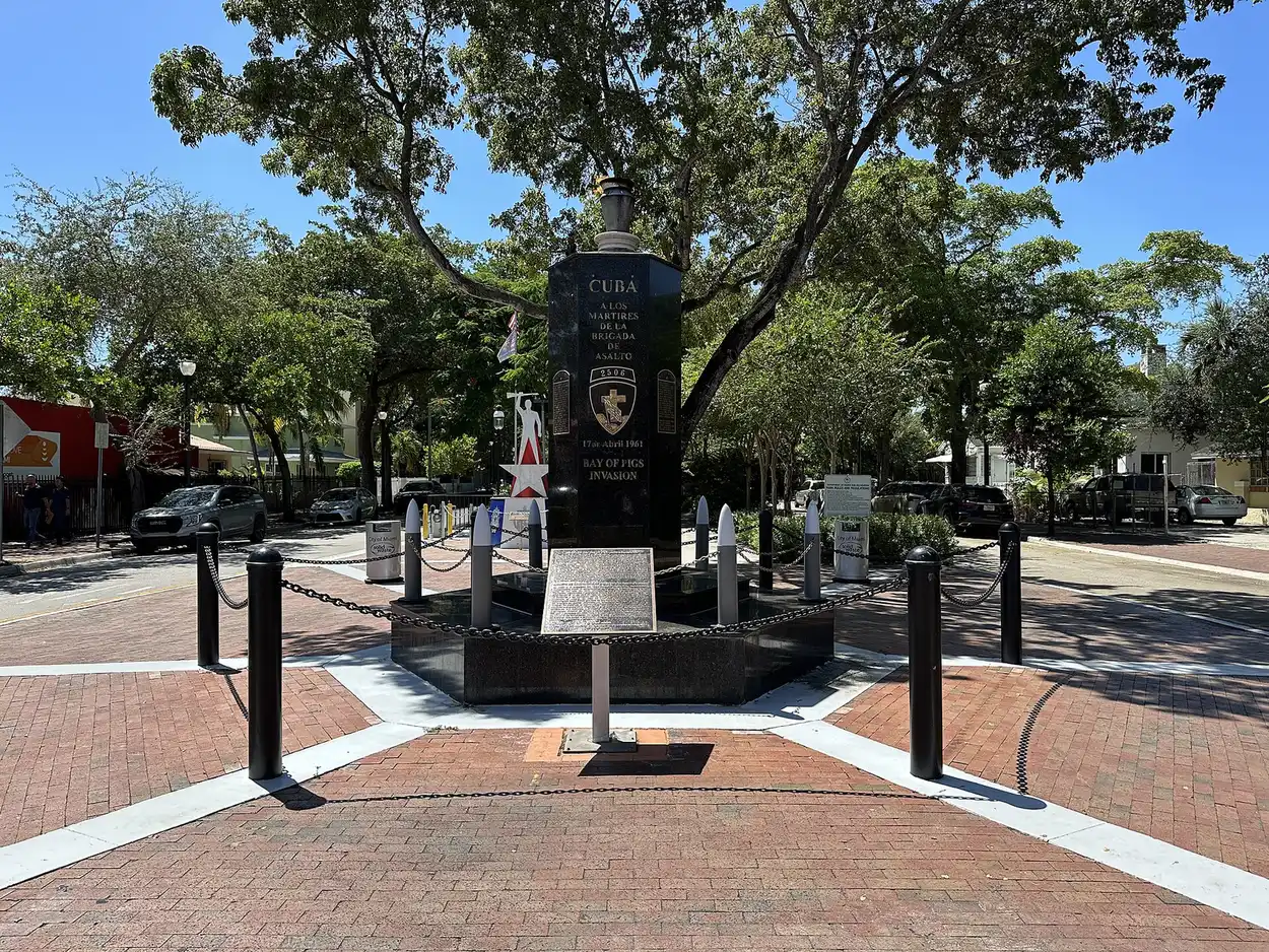
- Cuban Memorial Boulevard, the park strip on Southwest 13th Avenue at Southwest Eighth Street.
- Henderson Park, 971 NW Second St.
- Riverside Park, 342 SW Seventh Ave.
- Ernesto Lecuona Park, 900 SW First St.
- Orange Bowl Playground, Northwest Fourth Street at Northwest 17th Avenue.
Domino Park on Calle Ocho is in our Little Havana guide. More in our parks and trails guide.
Getting around
- Metrorail: Vizcaya station is inside the area at its southern tip. From the middle of the area, UHealth Jackson station is about 1.9 miles by road.
- Metrobus: routes 7, 8, 11, 12, 17, 22, 24, 27, 207, 208, 211 and 400 stop inside the area, on Miami-Dade Transit’s schedule data. Routes 207 and 208 are the Little Havana Connection.
- Free trolley: the City of Miami Trolley’s Little Havana, Coral Way and Stadium routes stop here.
- Downtown Miami (Government Center): about 2 miles by road from the middle of the area. Miami International Airport: about 5.9 miles.
- Distances are measured on the OpenStreetMap road network with the OSRM routing engine; they are distances, not drive times.
More in our getting around guide.
Groceries and everyday stores
From OpenStreetMap, inside the area:
- Publix, 121 SW 22nd Ave.
- Sedano’s Supermarket, 1263 W. Flagler St.
- Presidente Supermarket, 500 SW Eighth St.; 1895 SW Eighth St.; and 2294 W. Flagler St.
- Criollo Supermarket, 1651 W. Flagler St.
- CVS Pharmacy, 1177 SW Eighth St.
- Walgreens, 1699 NW Seventh St.
How we drew this area
This page uses the Little Havana outline on the City of Miami’s NET areas layer. The city’s outlines are drawn for service districts, so they are coarse at the edges. Address shares and school zones come from every Miami-Dade County address point inside it, matched to the county’s attendance boundary layers on Oct. 10, 2026. Store locations are © OpenStreetMap contributors.
Frequently asked questions
What high school is Little Havana zoned for?
About 61% of the area’s county address points are zoned for Miami Senior High, an A school in Florida’s 2026 grades. About 31% are zoned for Booker T. Washington Senior High and 8% for Miami Jackson Senior High.
What ZIP codes are in Little Havana?
Mainly 33125, 33135, 33130, 33129 and 33145. Zillow’s typical home values in August 2026 ranged from $462,144 in 33125 to $735,449 in 33145.
Is there a Metrorail station in Little Havana?
Vizcaya station is at the southern tip of the City of Miami’s Little Havana NET area, in The Roads. From the middle of the area, UHealth Jackson station is about 1.9 miles by road.
Is Little Havana a good place to live?
Here are the facts. Little Havana is about 2 miles by road from downtown Miami, has a dozen Metrobus routes and three free city trolley routes, and parks including Jose Marti Park on the Miami River. Most addresses are zoned for Miami Senior High, an A school in 2026.
Have your say