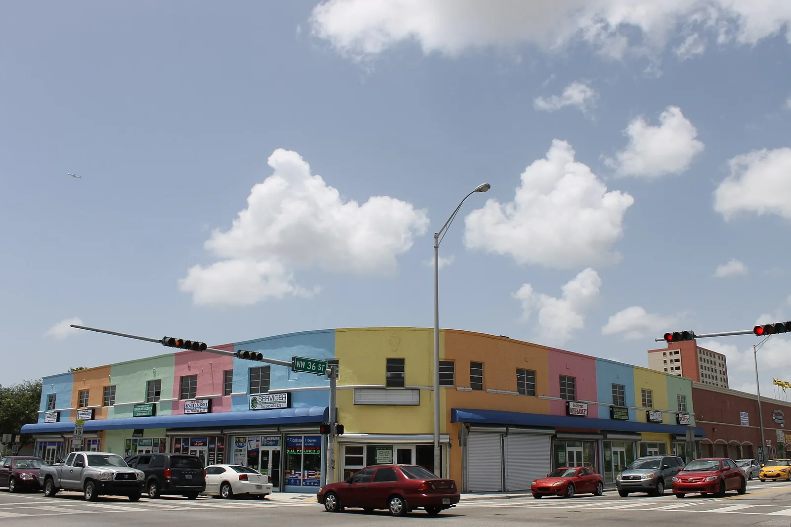
Allapattah, between the Airport and Dolphin expressways, is mostly in ZIP 33142, where Zillow's typical home value was $426,496 in August 2026.
Last checked Oct. 10, 2026. Sources: the City of Miami’s NET areas layer, neighborhoods layer and parks layer, Miami-Dade County’s open data (address points and school attendance boundaries), the Florida Department of Education’s 2026 school grades, Zillow Research, Miami-Dade Transit’s published schedule data and OpenStreetMap.
Allapattah is one of the 11 Neighborhood Enhancement Team (NET) areas the City of Miami uses to organize neighborhood services. It is a large, mostly flat stretch northwest of downtown with the Miami River and the Civic Center medical district at its southern edge, three Metrorail stations and, at its western end, the city’s Melreese golf course next to the airport.
What this means for you
- Zoned high school: Miami Jackson Senior High for about 78% of addresses, a B school in Florida’s 2026 grades. Check yours with the district’s School Locator.
- Home value: $426,496 in ZIP 33142 in August 2026, according to the Zillow Home Value Index.
- Nearest Metrorail: three stations inside the area; Santa Clara is about 1.2 miles by road from its middle.
Part of our Miami neighborhoods guide.
Where it is
On the city’s NET map, Allapattah runs roughly from Interstate 95 and Northwest Seventh Avenue west to the airport side of Northwest 37th Avenue, between the Airport Expressway (State Road 112) on the north and the Dolphin Expressway (State Road 836) and the Miami River on the south. Model City is to the north, Overtown to the east and Flagami and Little Havana across the expressway and the river.
The city’s neighborhoods layer names eight places inside it: Santa Clara, Melrose, the 36th Street Strip, the Allapattah Industrial District, the Civic Center, Curtis Park, North Grapeland Heights and North Sewell Park.
Miami-Dade County’s address data puts about half of the area’s address points in ZIP code 33142, about a third in 33125 and the rest in 33127.
Schools
How the area’s county address points fall in Miami-Dade County Public Schools’ attendance boundary maps, with each school’s 2026 grade from the Florida Department of Education. The percentage in parentheses is the share of possible points the school earned. Schools with under 3% of addresses are left out.
| Level | School | Share of addresses | 2026 grade |
|---|---|---|---|
| Elementary | Comstock Elementary, 2420 NW 18th Ave. (report card) | 21% | C (53%) |
| Elementary | Kensington Park Elementary, 711 NW 30th Ave. (report card) | 17% | C (49%) |
| Elementary | Maya Angelou Elementary, 1850 NW 32nd St. (report card) | 16% | C (50%) |
| Elementary | Santa Clara Elementary, 1051 NW 29th Terrace (report card) | 16% | C (53%) |
| Elementary | Paul L. Dunbar K-8 Center, 505 NW 20th St. (report card) | 14% | B (61%) |
| Elementary | Melrose Elementary, 3050 NW 35th St. (report card) | 8% | B (59%) |
| Elementary | Kelsey L. Pharr Elementary, 2000 NW 46th St. (report card) | 7% | A (73%) |
| Middle | Georgia Jones-Ayers Middle, 1331 NW 46th St. (report card) | 47% | B (61%) |
| Middle | Brownsville Middle, 4899 NW 24th Ave. (report card) | 27% | B (62%) |
| Middle | Citrus Grove Middle, 2153 NW Third St. (report card) | 26% | Not in the 2026 file |
| High | Miami Jackson Senior High, 1751 NW 36th St. (report card) | 78% | B (61%) |
| High | Booker T. Washington Senior High, 1200 NW Sixth Ave. (report card) | 14% | I (incomplete) |
| High | Miami Northwestern Senior High, 1100 NW 71st St. (report card) | 8% | A (66%) |
The area is split among seven elementary zones, so the street matters. “I” means the state listed Booker T. Washington’s 2026 grade as incomplete. Citrus Grove Middle has no row in the state’s 2026 grades file. Check the exact address with the School Locator. More in our schools guide.
Home values
The typical home value in ZIP 33142 was $426,496 in August 2026, almost unchanged from $426,384 in August 2025, according to the Zillow Home Value Index. The index is a modeled typical value for the middle third of homes, single-family homes and condos together, not a sale price, and it covers the whole ZIP code, not just this area. Zillow files 33142 under Brownsville, the neighboring community, because the ZIP crosses the city line.
| ZIP code | Share of area addresses | Typical value, Aug. 2026 | Change on the year |
|---|---|---|---|
| 33142 | 50% | $426,496 | 0.0% |
| 33125 | 32% | $462,144 | up 0.2% |
| 33127 | 17% | $529,035 | up 1.9% |
The citywide Miami figure was $580,866, up 0.8% on the year. More in our home prices guide.
Parks
From the city’s parks layer, inside the area:
- Melreese Golf Course, 1400 NW 37th Ave., about 128 acres.
- Grapeland Heights Park, 1550 NW 37th Ave., about 24 acres.
- Curtis Park, 1901 NW 24th Ave., about 22 acres.
- Moore Park, 765 NW 36th St., about 15 acres.
- Juan Pablo Duarte Park, 1700 NW 28th St., about 9 acres.
- Melrose Park, 2520 NW 31st St.
- Miami River Rapids Park, 2916 NW South River Drive.
More in our parks and trails guide.
Getting around
- Metrorail: the Allapattah, Santa Clara and UHealth Jackson stations are inside the area, on Miami-Dade Transit’s schedule data.
- Metrobus: routes 12, 17, 20, 21, 22, 27, 32, 36, 37, 42, 57, 77, 95 and 401 stop inside the area.
- Free trolley: the City of Miami Trolley’s Allapattah, Health District, Liberty City, Overtown, Stadium and Flagami routes all stop here.
- Downtown Miami (Government Center): about 3.4 miles by road from the middle of the area. Miami International Airport: about 5 miles.
- Distances are measured on the OpenStreetMap road network with the OSRM routing engine; they are distances, not drive times.
More in our getting around guide.
Groceries and everyday stores
From OpenStreetMap, inside the area:
- Publix, 1420 NW North River Drive
- Pardo Supermarket and Ricky’s Meats & Deli, 2614 NW 31st St.
- Walgreens, 1695 NW 20th St.
How we drew this area
This page uses the Allapattah outline on the City of Miami’s NET areas layer. The city’s outlines are drawn for service districts, so they are coarse at the edges. Address shares and school zones come from every Miami-Dade County address point inside it, matched to the county’s attendance boundary layers on Oct. 10, 2026. Store locations are © OpenStreetMap contributors.
Frequently asked questions
Where is Allapattah in Miami?
On the City of Miami’s NET area map, Allapattah runs from Interstate 95 west toward Miami International Airport, between the Airport Expressway (State Road 112) on the north and the Dolphin Expressway (State Road 836) and the Miami River on the south.
What high school is Allapattah zoned for?
About 78% of the area’s county address points are zoned for Miami Jackson Senior High, a B school in Florida’s 2026 grades. The rest are split between Booker T. Washington Senior High (14%) and Miami Northwestern Senior High (8%).
What ZIP code is Allapattah?
Mostly 33142, with large parts in 33125 and 33127. Zillow put the typical home value in 33142 at $426,496 in August 2026.
Is Allapattah a good place to live?
Here are the facts. Allapattah has three Metrorail stations, about a dozen city parks including Curtis Park and Grapeland Heights Park, and it is about five miles by road from Miami International Airport. Its zoned high school for most addresses, Miami Jackson Senior High, earned a B in 2026.
Have your say